So news spread pretty quickly throughout the ‘Gong about the new bush walking trail at Mt Kembla thanks to the Illawarra Mercury article – and as you can imagine I was super keen to get the boots on it! Not even waiting until the weekend, Friday after work was the first time I had available… With a kid tribe in tow, we set off to the start of the new section of the Mt Kembla Memorial Pathway starting at the intersection of Benjamin Road and Kirkwood Place (entry to Benjamin Road directly opposite the Primary School past the pub on the right).
The trail starts at an access gate with a few car parks available. The trail is essentially a service road converted to a walker friendly gravel trail. The trail is marked as 1.2km long with an easy consistent ascent. It’s definitely graded as an easy walk, it is a suitable trail for a 4WD pram and I would say a good walk to take the smaller toddlers on to get them out of the house and get used to the idea of bush walking . If you are after an easy start to trail running, this is also a good start, a reasonable ascent and a smooth path – and a short distance if you are starting out. The walk is approximately 40min return pending your exploring on the way.
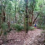
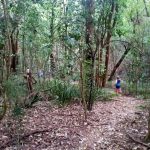
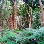
Essentially the walk from a naturalist point of view is rather disappointing. The ‘forest’ is almost completely Privet, a noxious weed. In true form it has made a tremendous impact on the environment with little to no under-story, bar some sparse bracken, Lomandra and ginger. I think I even spotted a Rhus Tree, which was even more concerning given it’s high toxicity and noxious nature. The track is dissected regularly by mountain bike trails that take advantage of the sparse woodland and steep sections around the well cut-in creek beds.
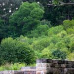
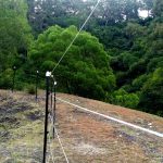
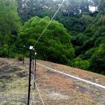
The walk is very clean and the new addition of fence posts over the steeper creek crevices make for a ‘country walk’ feel with a lovely bed of leaves on the road. Once you reach the top of the walk it opens out to a grassy knoll overlooking the steel works. There is a sign explaining the sites’ mining significance, but unfortunately there is not a lot of remnant features to discover. There is a large section surrounded by a pretty hard core electric fence, but no explanation as to why. Essentially this area as part of the Nebo Colliery handling plant where the coal was broken down into smaller pieces. The plant was originally opened in 1946, closing in 1993.
On the way back we decided to take one of the mountain bike trails down to mix it up a bit for the kids, which worked keeping them entertained running over the jumps. I’m not sure what the future plan is for this walk; obviously the noxious weeks are a problem and the issue of the mountain bike trails intersecting with pedestrians is a concern with yellow tape and signs already going up. I’d be curious to see what happens here with this walk, there is certainly a lot of potential as a significant addition to the existing memorial pathway, I would certainly like to see it become more of a historical walk with additional information on the area to assist the walkers on the path… maybe this is in the long-term planning?
Well done to the people who put this together…it’s always exciting to see a new walk pop up to explore, even if it’s not really a bushwalk as such.


For anyone interested I have added this track to OpenStreetMap – http://www.openstreetmap.org/#map=18/-34.42730/150.81658