Wollongong offers many walks rich in history and this is certainly one at the top of the list! A varied and interesting walk that takes in meandering rainforest trails, tall woodlands, open trails and a sad journey back in time through Wollongong’s mining history.
The path maybe a little rough, muddy and steep in places so ensure you wear appropriate footwear.
This walk is part of a suite of walks in the Mt Kembla area, easily accessible at the end of Cordeaux Road. The walk has a small car park, with small signage at the trail head it is well hidden but a small little National Parks and Wildlife Service (NPWS) signpost will lead you in the right direction at the left of the power-lines when looking East.
[youtube https://www.youtube.com/watch?v=pVOfsnWB-dU&w=560&h=315]
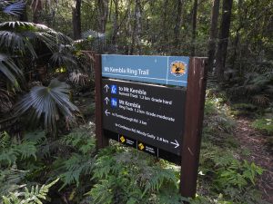
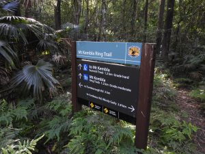
A few metres in, you will see the full NPWS signage board as well as a directional sign ahead marking the way to Kembla Summit or the Mt Kembla Ring Track. Take your time here and read about the history of the area and what animals to expect. To continue on, take the path on the right. At present the trail here is very barren looking, presumably from NPWS undertaking some extreme weed management, coupled with the dry weather conditions….but just wait for what lies ahead!
You very quickly reach the maintained staircase heading down into the rainforest consisting of wooden and stone steps. To help assist keeping steady on the steep steps, there are chain rails which you can peer over the sides into the forest. Take your time here as you are at canopy height, there are always birds frolicking and plenty of varied tree species you can enjoy. I’m yet to spot any rare Bangalow palms, but I keep looking! There are some magic looking rock formations here too which you should stop to enjoy also.
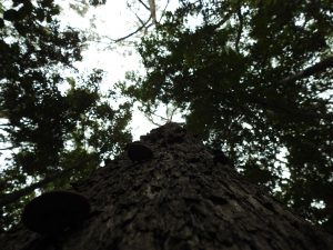
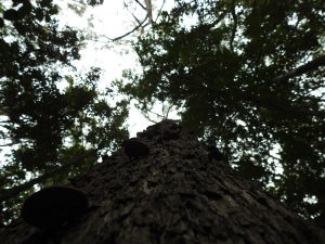
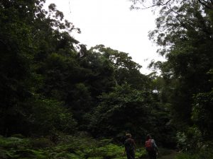
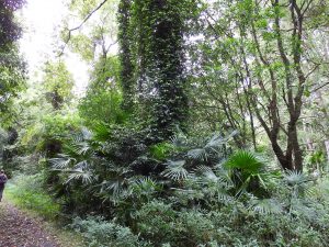
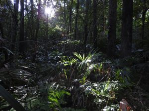
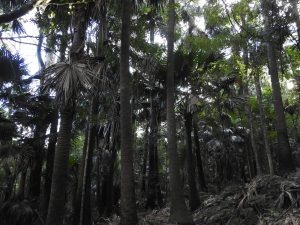
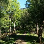
As you follow the mossy rock face down, you really begin to appreciate how lucky we are in Wollongong to have these beautiful forests so close. When you reach the forest floor, turn around and check out that rockface! From here you can really appreciate the Southern Mt Kembla mountainside, hosting a wonderful Cabbage Tree wonderland. You are instantly immersed in this jungle from the lower juvenile trees that splash palm fronds across your path, to the canopy of the ancient palms above. Take note of the tree trunks around you too, some very old specimens that have succeeded in protecting the rainforest beneath them through the storms and decades.
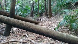
This rainforest is home to many Lyrebirds, you will likely hear their call and maybe even have some nice interaction on the trail with them. The pathway is quite clear, but can become littered with dead palm fronds from time to time so it’s important to pay attention to ensure you stay on the path. Along the way there is plenty to look at including fallen trees, beautiful mosses – and please keep remembering to look up at that impressive ceiling!
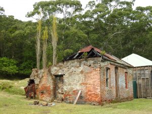
As you near the end of the rainforest section you will cross a small wooden bridge before you reach the sunlight on the wide service trail. At this point you can choose to continue on the ring track, or take a historical diversion to the pit pony stables. To check out the stables, follow the service trail South, down the hill which is less than a 10min walk. Follow until you reach the old stables and tennis court. The stables are rightly so, protected, so ensure you are respectful of the area. (For more information on the pit ponies, pay a visit to the Mt Kembla Museum) To return back on the ring trail, simply return back on the same trail to the junction point with the rainforest and signage, continue North along the service trail back on the ring track.
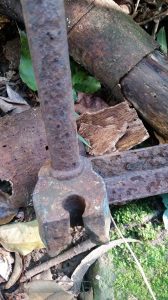
The ring track will take you past the pit pony dam on your left, just after the junction. Here the ponies had a well deserved drink back in the day. You continue on the service trail which is a nice cruisy stroll through bush land and old rural land. You will note the large coral trees, a homage to the past orchards that graced the side of Mt Kembla. You may even notice remnants of old structures that stood here in the times of past mining and farming in the area. There are old mine sites in the area, unfortunately the trails have long overgrown and are thick with Giant Stinging Trees and nettle so are not suitable for clear directions.
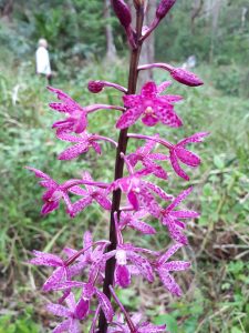
Depending on the time of year, the trail hosts some beautiful orchids, native plants and animals to enjoy – I’ve seen shy wallabies so keep an eye out. On the flip side, I have seen literally a herd of feral goats in there too, as well as the typical deer we have come to expect on the escarpment (just ask the locals who live on the fringe!).
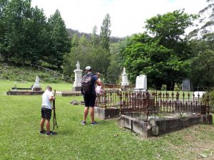
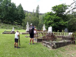
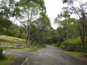
You continue to follow the trail right until the end until you reach the road. To finish the loop you need to continue up the road to your start point. It’s really a special wander, although not an actual bushwalk on the last leg, Windy Gully provides a visually rich history of the area, and you literally feel like you have stepped back in time (except for the asphalt!). You will walk straight past the Windy Gully cemetery, which I highly recommend you stop by to pay your respects. This cemetery commemorates the lives lost in Australia’s largest industrial accident. At 3.02pm on 31st July 1902, a huge explosion claimed the life of 96 men and boys, and about a dozen pit ponies. It’s worth a read of the history to understand what this community endured for many years to come as a consequence of this day (see Resources below).
After you have visited the cemetery continue wandering up the road past miners cottages until you reach the carpark again.
Parking and Transport:
There is no public transport, but the carpark is good and very visible from the road. Many people get lost trying to make it up to the carpark, just remember you need to turn left to continue on Cordeaux Rd, not right onto Harry Graham Drive. You will go through Windy Gully and pass an old cemetery and very old buildings, just keep going, you’ll easily find the carpark with the powerlines where the trail starts.
Directions:
Here are the directions to the carpark.
Trail Advice:
This trail has steep sections. So people with knee issues or poor fitness will struggle. It is completely suitable for younger children, naturally with a close eye. Ensure safety at all times as there are some steeper sections. There is a high chance of leeches in this area after rain, so take adequate protection. Some areas are slippery underfoot with loose rocks so there is a risk of spraining ankles or falling, so take your time, check your footing before you put your weight down. In the warmer months, be cautious of snake danger on the open sections of the trail.
You need to complete the trail on a section of road, so take precautions against cars and keep an eye on young children.
Signage and Track Condition:
Signage is below average on this trail. There is good signage at the beginning, and that’s about it. It is generally fairly easy to navigate as there is a well worn trail. The track condition is good, there are stair sections and chain barriers.
It is very important that individuals do their best to stay on the main trail to avoid erosion and damage to the delicate environment. This is not too difficult and is critical to the ongoing integrity and future access of the trail.
Data & Cellular Coverage:
There is generally excellent reception on this trail. Always carry a basic first aid kit in case of an emergency. Google maps works too with the trail marked out on it (helpful!)
Demographic:
This track is great fun for younger and older families and all ages. People with knee or hip issues will likely struggle in some sections. It is steep in sections, but taking your time even the unfit could take this on, but average fitness is highly recommended to get the most out of the walk. It is a little long at about 3hrs, but a varied walk so you should be able to hold the interest of the kids.
Fitness:
Want to know where you are going to hurt the next day? In general, an easy walk for people with moderate fitness, so don’t expect to be sore the next day.
Hiking Grade: Grade 2
A slightly longer walk with a couple of steep stairs and rough underfoot in sections. Generally a good beginner trail for confident walkers.
Distance and Time:
The track is a round trip being roughly a 3hr walk . Distance is approximately 5.3km return.
Pollution/Rubbish Status: Grade 2
Generally this trail does attract some small amounts of litter especially on the service trail. The carpark is particularly bad and the road up is a disaster, thankfully most of this doesn’t make it to the trail.
Please ensure you take a garbage bag to collect rubbish, and don’t forget to take a photo of your collection and tag us in #bushwalkthegong #cleanupgongsbushland – let’s spread the word that littering in or around our bushland areas is NOT OK!
Prohibited:
All dogs (except for assistance dogs), bikes and smoking – and especially alcohol.
References and Resources:
https://www.mtkembla.org.au/the-disaster

