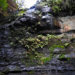
A luscious walk back in time to an oasis of mossy rocks, a waterfall and a deep history of coal mining in the Southern Highlands. This short walk ticks all the boxes as a lovely day out or a small adventure suitable for all.
This trail has a water element so it’s important to be cautious, especially with children. Be mindful of rainfall, heavy rains may cause an unsafe crossing and care should be taken near the waterfall and creek. The path maybe a little rough in places so ensure you wear appropriate footwear.
This walk is part of a suite of walks in the Morton National Park, just a hop, skip and a jump from the charming Bundanoon township. The walk is easily found and has a large rest area and car park (Gambells Rest Campground) with a great NPWS information board showing the various walks in the area.
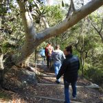
The trail start is the first track as you drive in on the right, with a clear trail and a signpost. The walk starts nice and flat through heath and woodlands with the bonus of some interesting signs along the way educating you on the plants, geology and history along the way. The trail is nicely maintained with earth and wood steps in the steeper sections on the way down. There is plenty of biodiversity and wildflowers at the right time of year. It’s an enjoyable walk down hill with some minor stair cases that are nice and sturdy.
Click here for full photo album.
You continue to you reach the Coal Creek crossing. We were lucky that there wasn’t much water so an easy cross, however there is steps to get you across when the water flow is higher. This crossing is the top of the waterfall and is chained off, so pay attention – don’t go past the barriers, they are there for your safety!
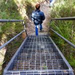
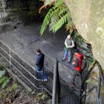
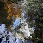
From here on, things get serious. Like seriously gorgeous and breathtaking! You then proceed down a set of metal stairs on the side of the waterfall, sorry if you are scared of heights – but you can keep a strong grip on the handrail! The stairs lead you to a natural grotto of sorts, a magic pool reflecting the sky above and haunting memories of the mining history on your right, whilst being surrounded by cliffs.
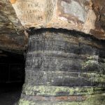
Take your time here on these stairs. Have a think about the reality of this situation and the walk you have just been on to get here. Rewind 120 years, and think of the walk, no stairs, no steps and the men who would of come here to work firstly as Rock-roof Mine in 1871, then renamed to Erith Colliery in 1881. Firstly, what a glorious place to work… but reality, a difficult location and hard labour would follow. The seam is relatively small at about 1m approximately and of a low grade, the mine only produced a limited amount of coal for the railways. Interestingly, there were wooden platforms suspended from the top of the cliff, and through these platforms the coal was hoisted up about 25m and pulled by horse to the light railway. Have a good look and see what remnants of the wooden frames you might see.
So once you have finished contemplating your surroundings, you can have a nice little explore of the mine. Noting the old beams and having a good walk around the ‘caves’ remaining. The shafts are fenced off, obviously for safety as they go back 1.4km, but you get a great feel anyway. Bring a little torch and you can see quite a way in through the fences easily.
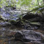
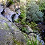
From here you can simply stop and take in the gorgeous grotto, it’s green, it’s lush, it has a stunning waterfall! Or you can continue, it’s not really much of a trail, but you can see your destination at the bottom of the falls. It’s a little rough in places for the less experienced walker, but not dangerous maybe a little slippery with the leaf litter. When you reach Coal Creek, there is a rustic plank crossing and you can really take in this amphitheater and waterfall. Don’t rush away – just breathe it all in! You can even continue down stream a little if you want to explore a little more.
Once you drag yourself away, continue the way you came back up the stairs. When you cross the top of the waterfall, you have the option to continue back on the trail you came, or take the trail to the right which leads you back onto a road. We took the dirt road to mix it up a bit. It’s pretty steep on the way out – remember when you walked down all of those stairs and trails…yes you have to go up again to get back to your car! Take your time or run it, whatever takes your fancy! It’s an easy walk back and you will recognise the car park on your return.
Parking and Transport:
There is no public transport, so it’s a recommended day trip by car from Wollongong. Google maps will easily get you there, and you have the option to go via the Hume Hwy or through Macquarie Pass. I personally prefer Macquarie Pass as it’s so beautiful – even if I do get carsick, and then you get the option to stop at Robertson Pie Shop also!
There is an entry fee to Morton National Park, it is $8 per car. The day I went the Credit Card facility was broken. So I’d suggest have cash and card available just to be safe. There are fines if you don’t display a valid ticket – so you know the right thing to do!
Directions from Bundanoon:
[googlemaps https://www.google.com.au/maps/d/embed?mid=1ei-UG4PYkqeFEJO5E_CgMcdjUBA&w=640&h=480]
Trail Advice:
This trail is steep on the way in and out. So people with knee issues or poor fitness will struggle. It is completely suitable for younger children, naturally with a close eye. This trail is ends in a creek bed, which means you have a high water hazard. Ensure safety at all times. There is a high chance of leeches in this area being a typical wet forest, so take adequate protection. The rocks can also very slippery around the creek and there is a risk of spraining ankles or falling, so take your time, check your footing before you put your weight down. In the warmer months, be cautious of snake danger on the open sections of the trail.
Signage and Track Condition:
The track is well signposted including informational signage along the way. The car park has a good information board which will also provide information on other walks in the area. The walk back on the dirt road is also in reasonable condition, however signage is limited this way, but virtually no risk of getting lost.
Data & Cellular Coverage:
There is limited coverage on this walk, however due to the signage and well carved trails it is easy to navigate. Always carry a basic first aid kit in case of an emergency.
Demographic:
This track is great fun for families and all ages, there is plenty of interest along the walk and you may even consider a swim in the cool waters. It is steep, but taking your time even the unfit could take this on, but reasonable fitness is highly recommended to get the most out of the walk.
Fitness:
Want to know where you are going to hurt the next day? This track will use your quads and glutes mostly, with some calf work on the steep road out. A little cardio fitness will kick in once you start making your way out of the walk back up the hill. In general, an easy walk for people with moderate fitness, so don’t expect to be sore the next day.
Hiking Grade: Grade 3
Although a fairly short walk, this grades at a 3 as there are stairs and it’s quite steep when you walk out.
Distance and Time:
The track is a round trip being roughly a 1hr walk . Distance is approximately 2km return.
Pollution/Rubbish Status: Grade 4
I picked up a few bits and pieces, but it was really clean in general. This is a grade 1 in terms of rubbish, barely anything and possibly just some accidental drops.
Please ensure you take a garbage bag to collect rubbish, and don’t forget to take a photo of your collection and tag us in #bushwalkthegong #cleanupgongsbushland – let’s spread the word that littering in or around our bushland areas is NOT OK!
Prohibited:
All dogs (except for assistance dogs), bikes and smoking – and alcohol.
References:
